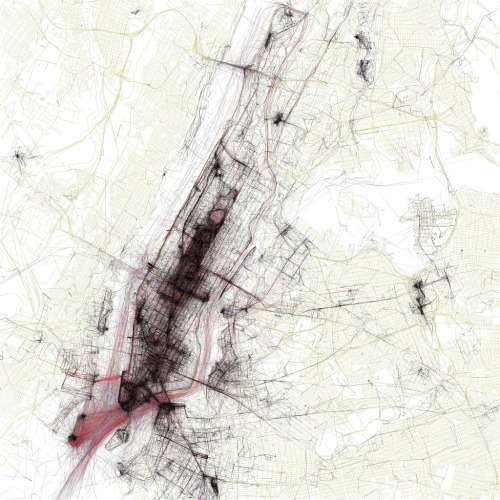
"The maps are ordered by the number of pictures taken in the central cluster of each one. This is a little unfair to aggressively polycentric cities like Tokyo and Los Angeles, which probably get lower placement than they really deserve because there are gaps where no one took any pictures. The central cluster of each map is not necessarily in the center of each image, because the image bounds are chosen to include as many geotagged locations as possible near the central cluster. All the maps are to the same scale (a square measuring 15 miles on each side), chosen to be just large enough for the central New York cluster to fit. The photo locations come from the public Flickr and Picasa search APIs."
The Geotaggers' World Atlas (thumbnails, Flickr)
“Patriotism is your conviction that this country is superior to all others because you were born in it”George Bernard Shaw